

Application Description
Are you ready? Jacksonville, FL's JaxReady is your essential tool for preparing and responding to natural disasters. Brought to you by the Emergency Preparedness Division and Information Technologies Division of the City of Jacksonville, Florida, JaxReady equips you with the resources needed to monitor weather threats and plan your evacuation effectively.
Features:
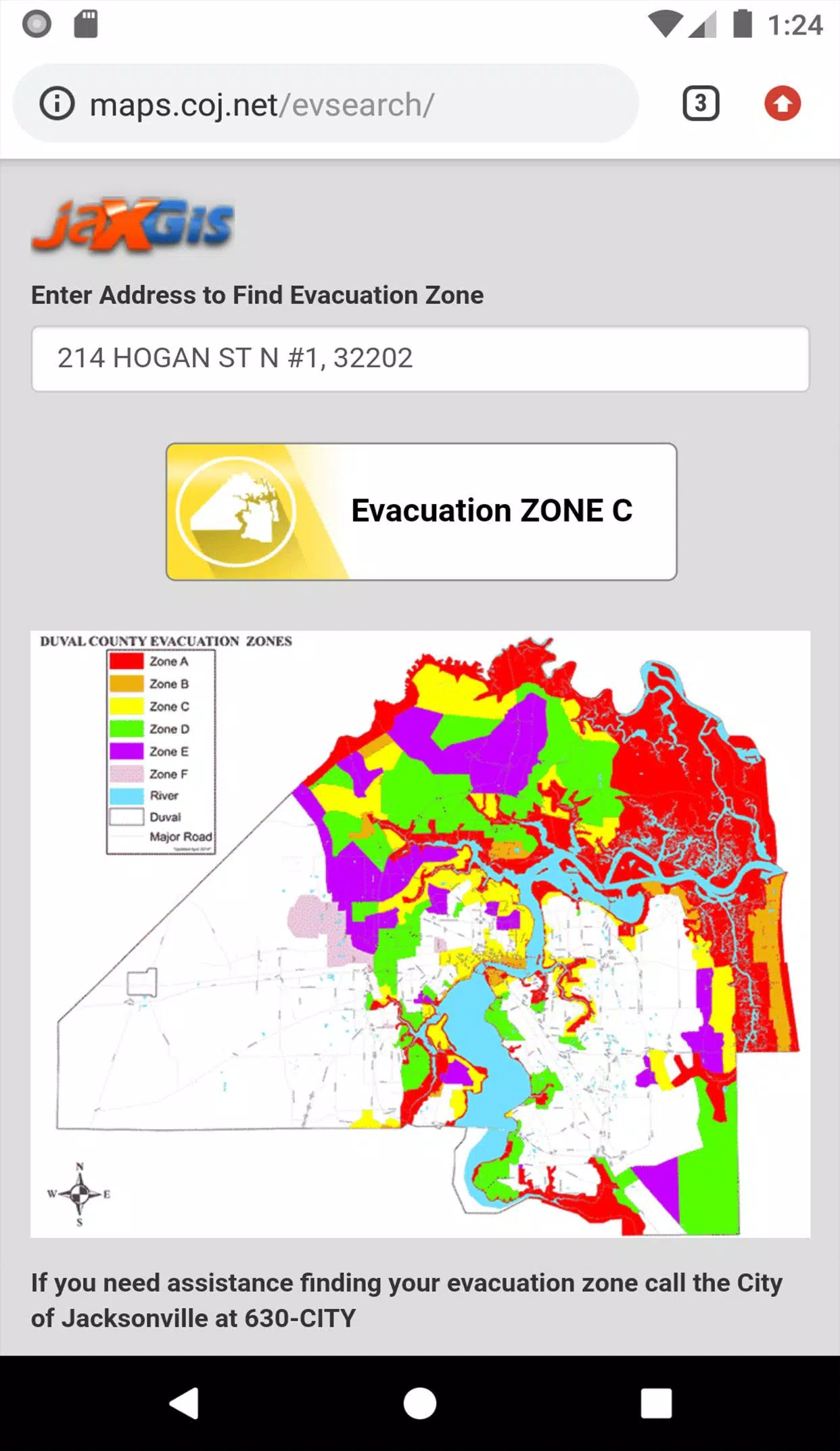
GPS Functionality: Easily locate your designated Evacuation Zone with pinpoint accuracy.
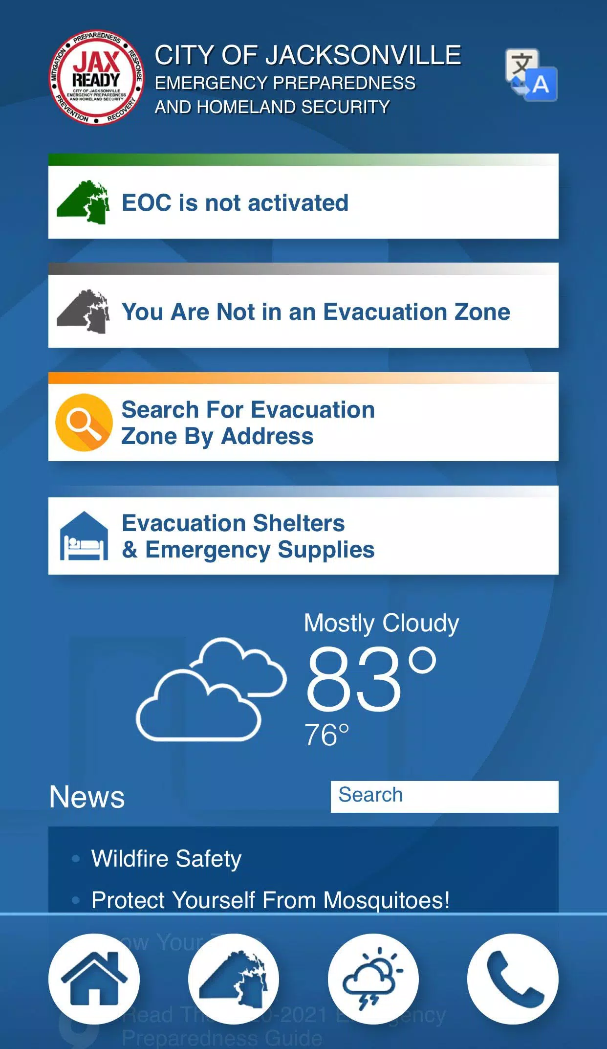
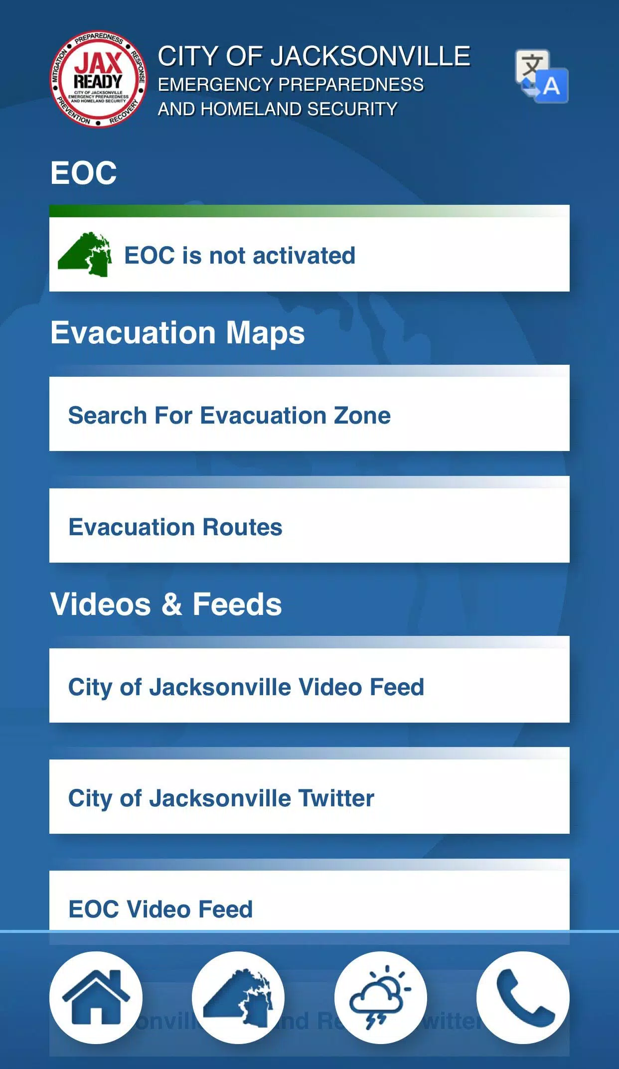
Real-Time Alerts: Stay informed with the current Emergency Operations Center (EOC) Activation Level, Weather Threat Level, and Fire Danger Index, all tailored to your specific geolocation.
Special Needs Support: Access links to register for special needs services, ensuring those with medical requirements are well-cared for during an evacuation.
Comprehensive News Feeds: Get the latest weather and fire news to stay updated on potential threats.
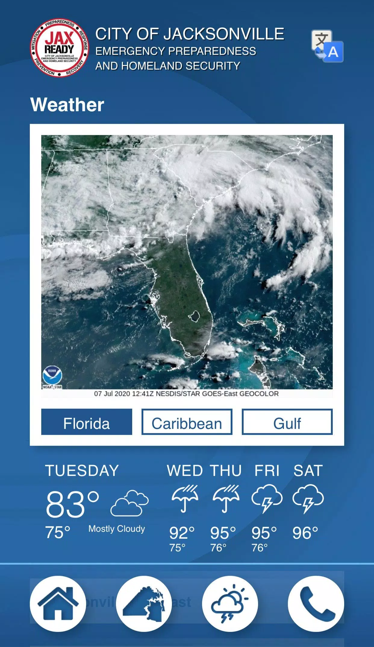
Detailed Maps: View up-to-date weather, wildfire, and drought index maps to better understand the situation around you.
With JaxReady, you're not just preparing for a natural disaster—you're staying ahead of it.
JaxReady Screenshots
Reviews
Post Comments
Trending Games
Trending apps


![NULL [Remastered]](https://imgs.39man.com/uploads/71/1719651062667fcaf6c483b.png)


Topics
More
Top-Rated Productivity Tools to Boost Your Workflow
Best Casino Games Online
Essential Other Apps for Your Phone
Best Role Playing Games for Android
Epic Adventure Games: Explore Uncharted Worlds
Hyper-Casual Games: Fun and Addictive Mobile Games
Top Arcade Classics and New Hits
Best Media & Video Players for Android
Latest Articles
More


Magic Strike: Lucky Wand Beginner's Guide
Apr 23,2025
Top 10 Super Mario Games Ever
Apr 23,2025