

Application Description
City routes, live traffic, transit routes, parking, offline maps, and navigation.
We are excited to announce that we have updated 2GIS. The current version of the app has become challenging to display all the information we have gathered about cities and companies. In the new 2GIS, we have revamped the design, introduced a new search feature, enhanced city updates, and integrated favorites with 2gis.ru.
Services, Addresses, and Companies
2GIS is your go-to source for detailed information. It knows which utility provider services your home, where to find your local hospital or post office, and helps you select cafes or service centers based on reviews and photos. It also provides opening hours and contact numbers for your convenience.
Transport and Navigation
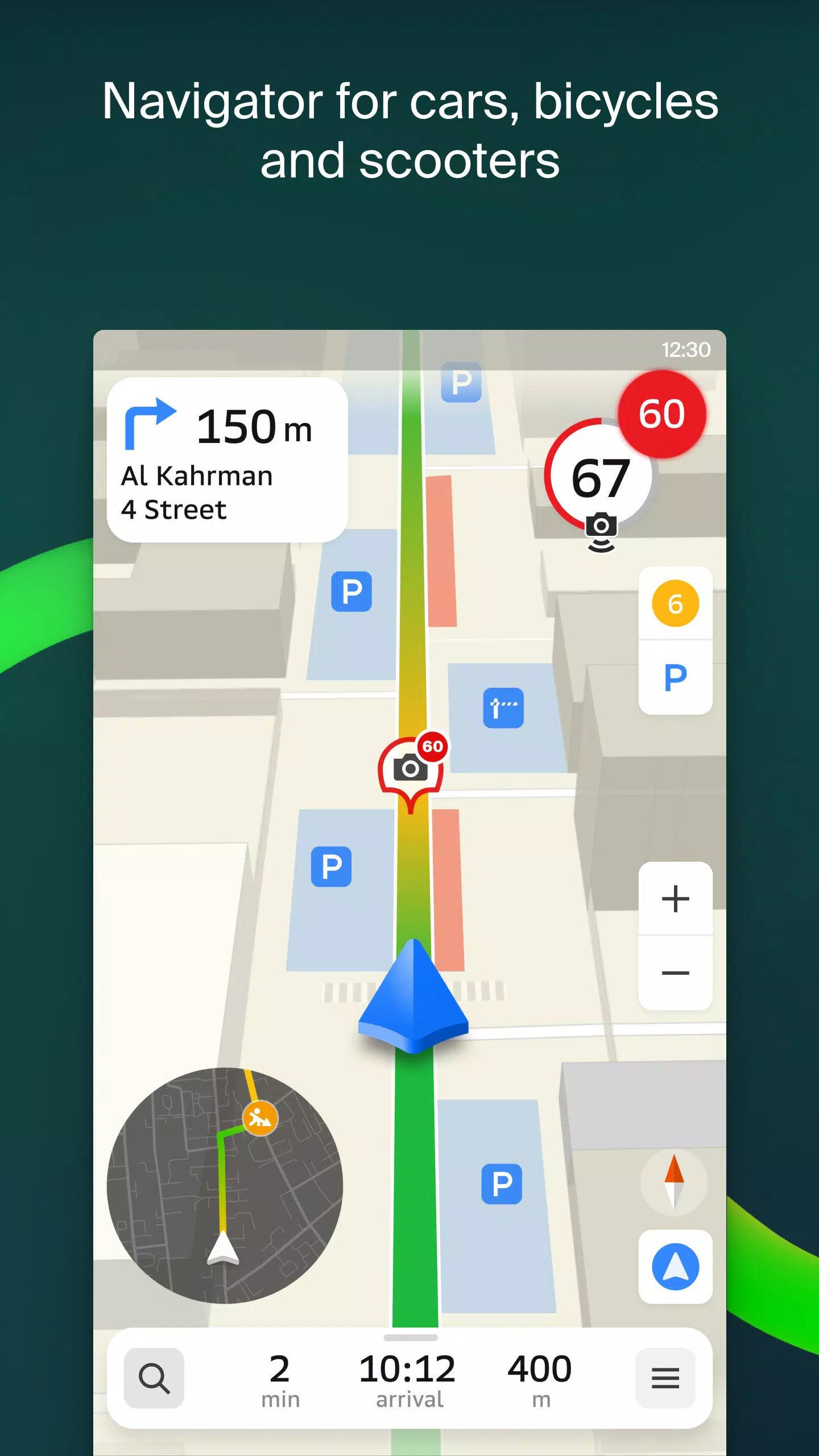
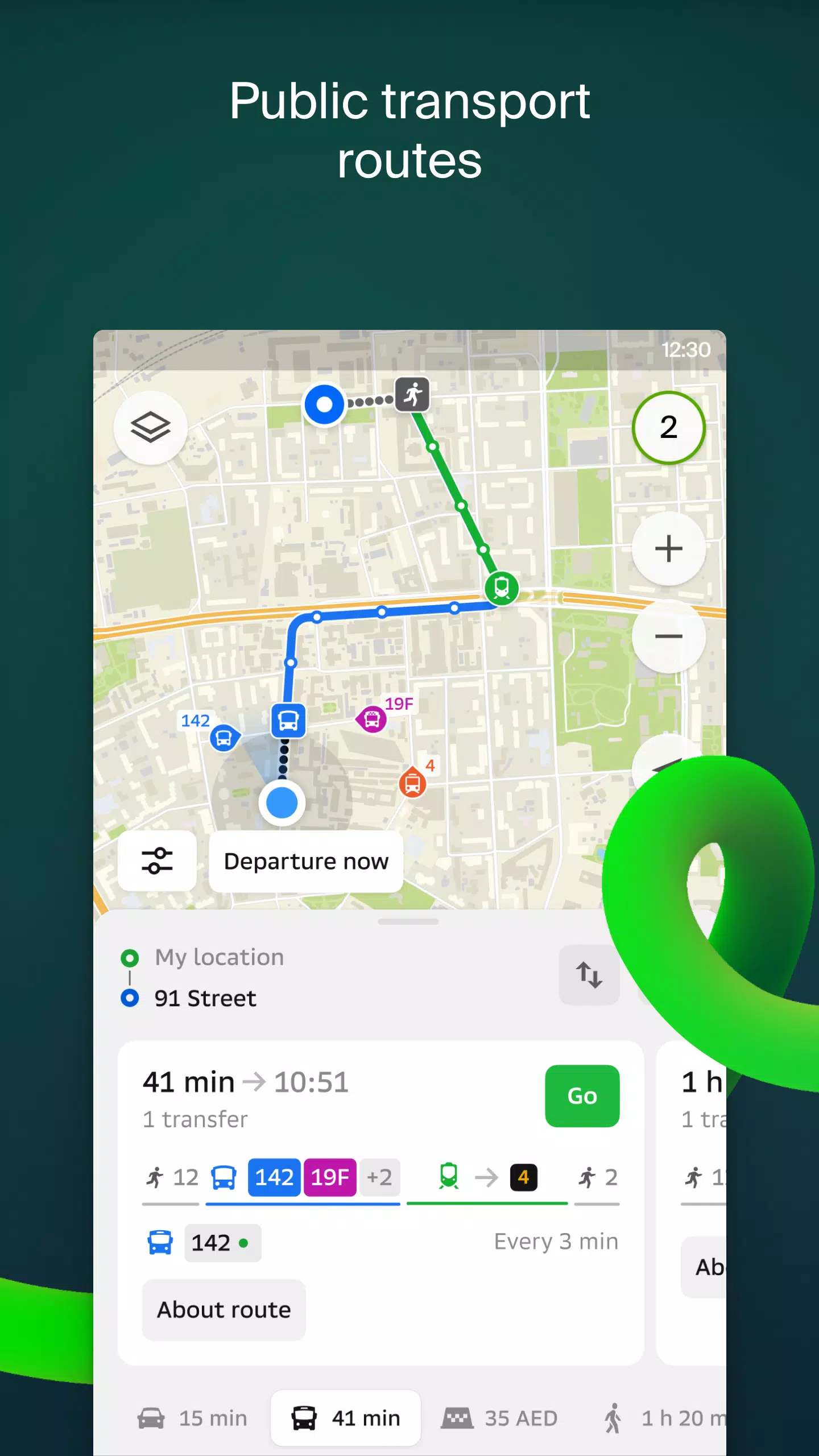
For drivers, 2GIS offers real-time navigation with voice instructions, taking into account traffic jams and road closures. If you stray from your route, the app will automatically recalculate the best path. For pedestrians, it offers multiple transit options including buses, metro, trains, cable cars, and river trams.
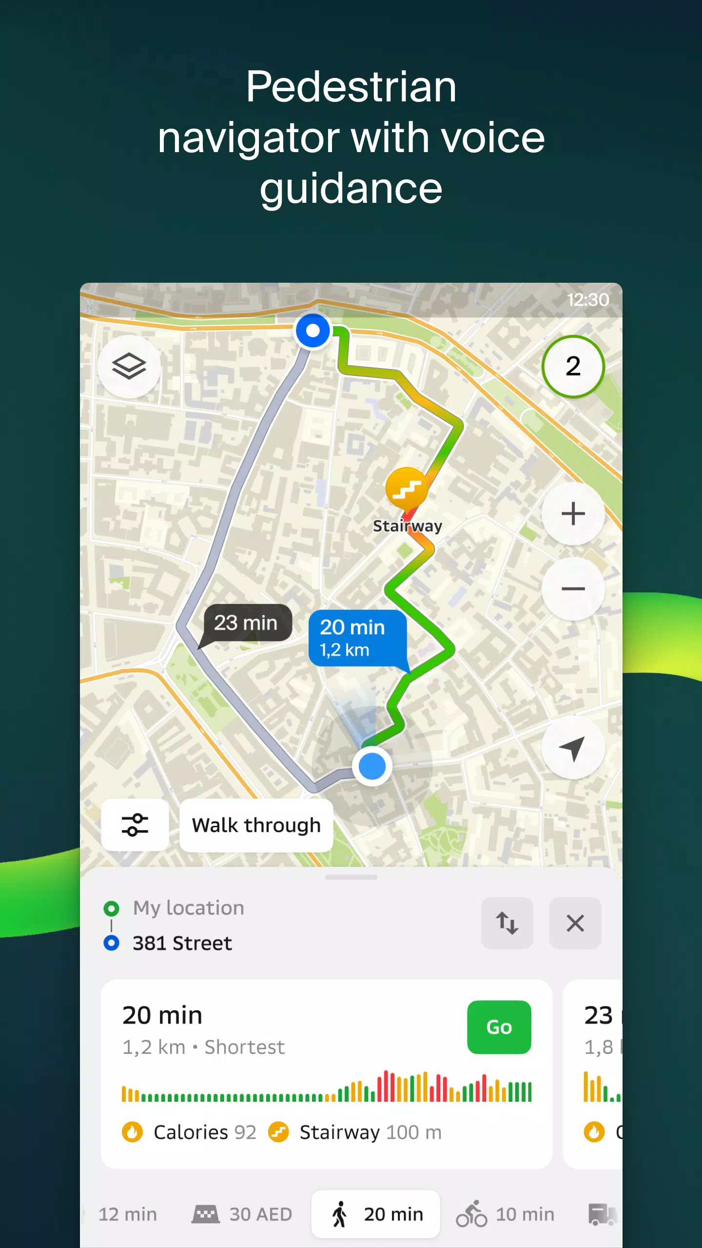
Walking Routes
Pedestrian navigation in 2GIS charts a course wherever you can walk, with background operation and voice guidance to assist you along the way.
Friends on the Map
With 2GIS, you can now see the real-time location of your friends and family on the map. You control who you add as friends and who can view your location, with settings to manage your visibility.
Building Entrances
Avoid the hassle of searching for building entrances. 2GIS has detailed information on how to access over 2.5 million companies, guiding you right to the door whether you're traveling by public transport or car.
Plans of Shopping Centers
Navigate inside shopping centers effortlessly with 2GIS. The app displays everything from shops and cafes to ATMs and restrooms, helping you plan your visit in advance.
2GIS Beta Notifications Companion App for Smart Watches on Wear OS
Enhance your navigation experience with the 2GIS beta companion app for Wear OS smartwatches. This handy tool allows you to navigate on foot, by bike, or by public transport directly from your wrist, with map viewing, maneuver hints, and vibration alerts when approaching a turn or your destination. The companion app starts automatically when you initiate navigation on your phone and is compatible with Wear OS 3.0 and later versions.
As a beta user, you'll receive the latest updates as we fix bugs and errors, contributing to the development of the new 2GIS version that will be used by millions. You can keep the original version installed, as the beta version runs concurrently, allowing you to switch between them at any time.
Support: [email protected]
What's New in the Latest Version 6.44.1.559.3
Last updated on Oct 19, 2024
We've made some beautiful, crisp updates for you in this latest version:
- We now display wide, realistic roads on the main map and during route searches.
- Introducing Chats for Friends! Now you can message each other without leaving the map.
- Added notifications when a friend is nearby, which you can turn off in settings.
- Just in time for ski season, we've added ski lift statuses on slopes so you can see if they're open.
- For public transport routes that include walking, we now calculate the walking portion in steps.
2GIS beta Screenshots

Reviews
Post Comments
Trending Games
Trending apps


![NULL [Remastered]](https://imgs.39man.com/uploads/71/1719651062667fcaf6c483b.png)


Topics
More
Top-Rated Productivity Tools to Boost Your Workflow
Best Casino Games Online
Essential Other Apps for Your Phone
Best Role Playing Games for Android
Epic Adventure Games: Explore Uncharted Worlds
Hyper-Casual Games: Fun and Addictive Mobile Games
Top Arcade Classics and New Hits
Best Media & Video Players for Android
Latest Articles
More


LG Evo C3 4K OLED TV Now Under $1,200 on Amazon
Apr 28,2025