
Application Description
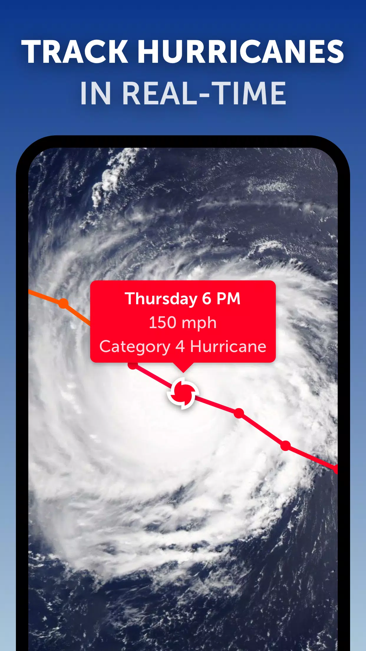
Zoom Earth is your go-to platform for tracking hurricanes, typhoons, and tropical cyclones in real-time, offering a comprehensive suite of tools to keep you informed and prepared. As an interactive global weather map, it features an advanced real-time hurricane tracker, ensuring you stay updated on the latest storm developments.
Key Features:
Satellite Imagery: Zoom Earth provides detailed weather maps with near real-time satellite imagery sourced from NOAA GOES, JMA Himawari, EUMETSAT Meteosat, and NASA's Aqua and Terra polar-orbiting satellites. This feature is crucial for monitoring the progression of tropical storms across the globe.
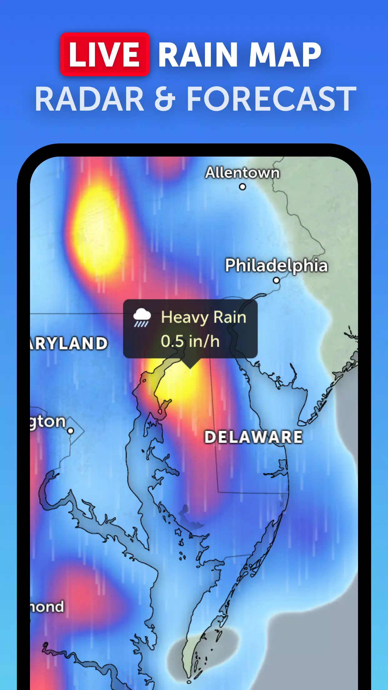
Rain Radar: Stay one step ahead with our dynamic weather radar map, which displays real-time rain and snow detected by ground-based Doppler radar. This tool is essential for understanding the immediate impact of tropical cyclones on your area.
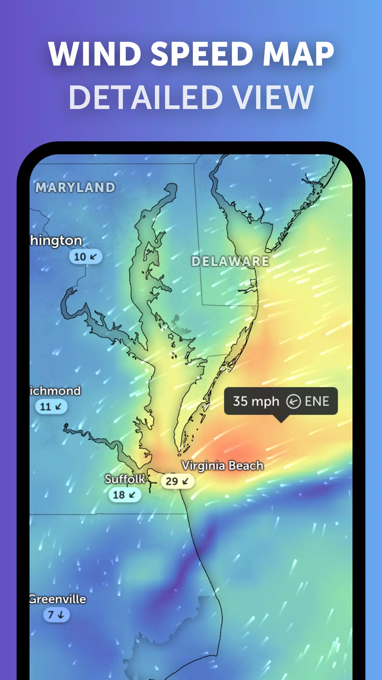
Weather Forecast Maps: Delve into interactive and visually stunning global forecast maps that include crucial data points like precipitation, wind speed and gusts, temperature, "feels like" temperature, relative humidity, dew point, and atmospheric pressure forecasts. These maps help you predict the path and intensity of hurricanes and tropical storms.
Hurricane Tracking: Our state-of-the-art tropical tracking system uses the latest data from the National Hurricane Center (NHC), Joint Typhoon Warning Center (JTWC), Naval Research Laboratory (NRL), and the International Best Track Archive for Climate Stewardship (IBTrACS). Follow the journey of a hurricane from its inception to its potential growth into a Category 5 storm in real-time.
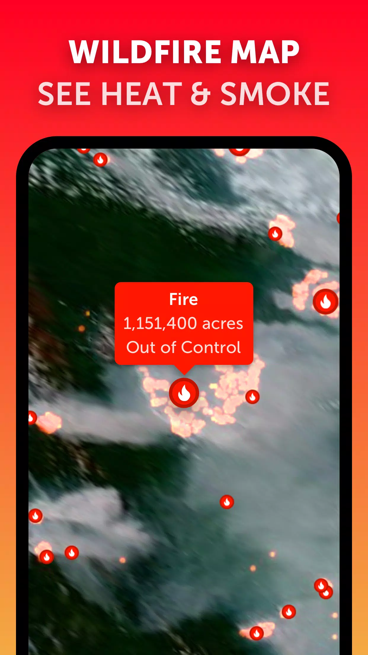
Wildfire Tracking: While primarily focused on hurricanes, Zoom Earth also offers the ability to monitor wildfires through an active fires and heat spots overlay. This feature uses daily updates from NASA's Fire Information for Resource Management System (FIRMS) to show points of very high temperature, which can be relevant in regions affected by tropical storms.
Customization: Tailor your experience with customizable settings, including temperature and wind units, time zone adjustments, and various animation styles. This ensures that you can view the data in a way that best suits your needs during hurricane season.
What's New in the Latest Version 3.1
Last updated on Sep 19, 2024
- Enhanced user experience with reduced clutter when viewing multiple tropical systems.
- Improved alert systems with separate notifications for Atlantic and Eastern Pacific systems.
- Enhanced map labels for better readability and understanding of storm paths and intensities.
With these features and updates, Zoom Earth remains the premier tool for tracking hurricanes, typhoons, and tropical cyclones, ensuring you're always informed and ready to take action.
Zoom Earth Screenshots
Reviews
Post Comments
Trending Games
Trending apps


![NULL [Remastered]](https://imgs.39man.com/uploads/71/1719651062667fcaf6c483b.png)