

Application Description
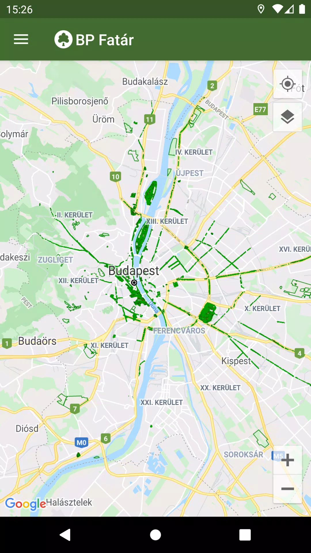
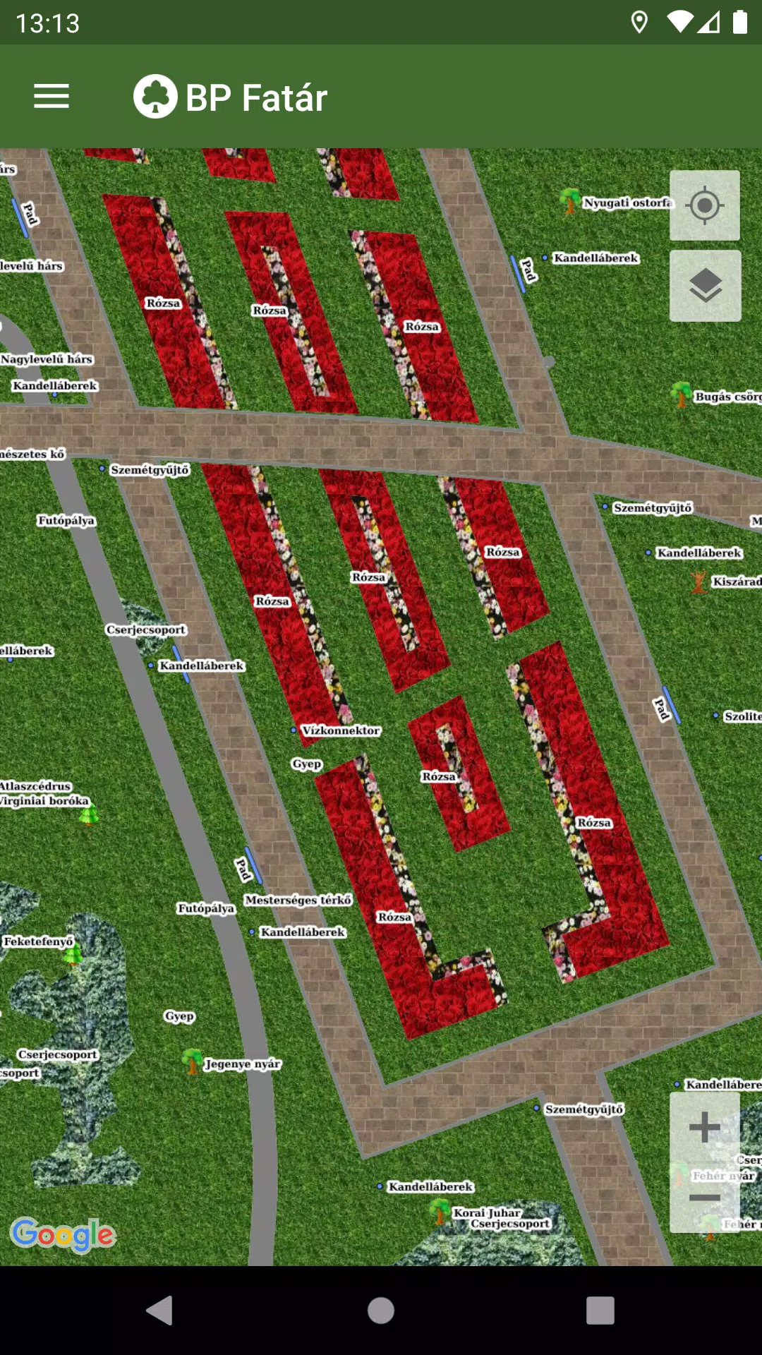
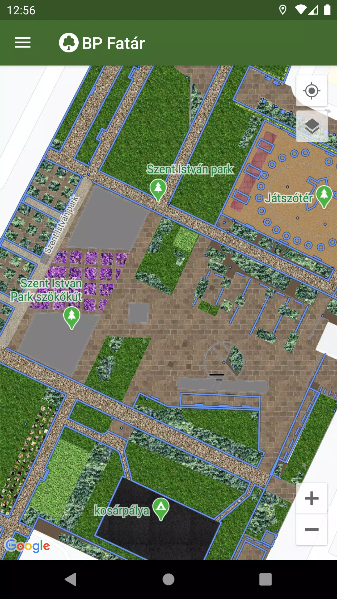
Discover the official tree and park cadastral application brought to you by the MAIN GARDEN. With the BP Fatár application, you can explore the public tree and park cadastre of FőKERT and delve into additional cadastres from various district municipalities, including:
- I. district municipality
- VI. district municipality
- X. district municipality
- XI. district municipality
- XIII district municipality
- XIV. district municipality
- XVIII district municipality
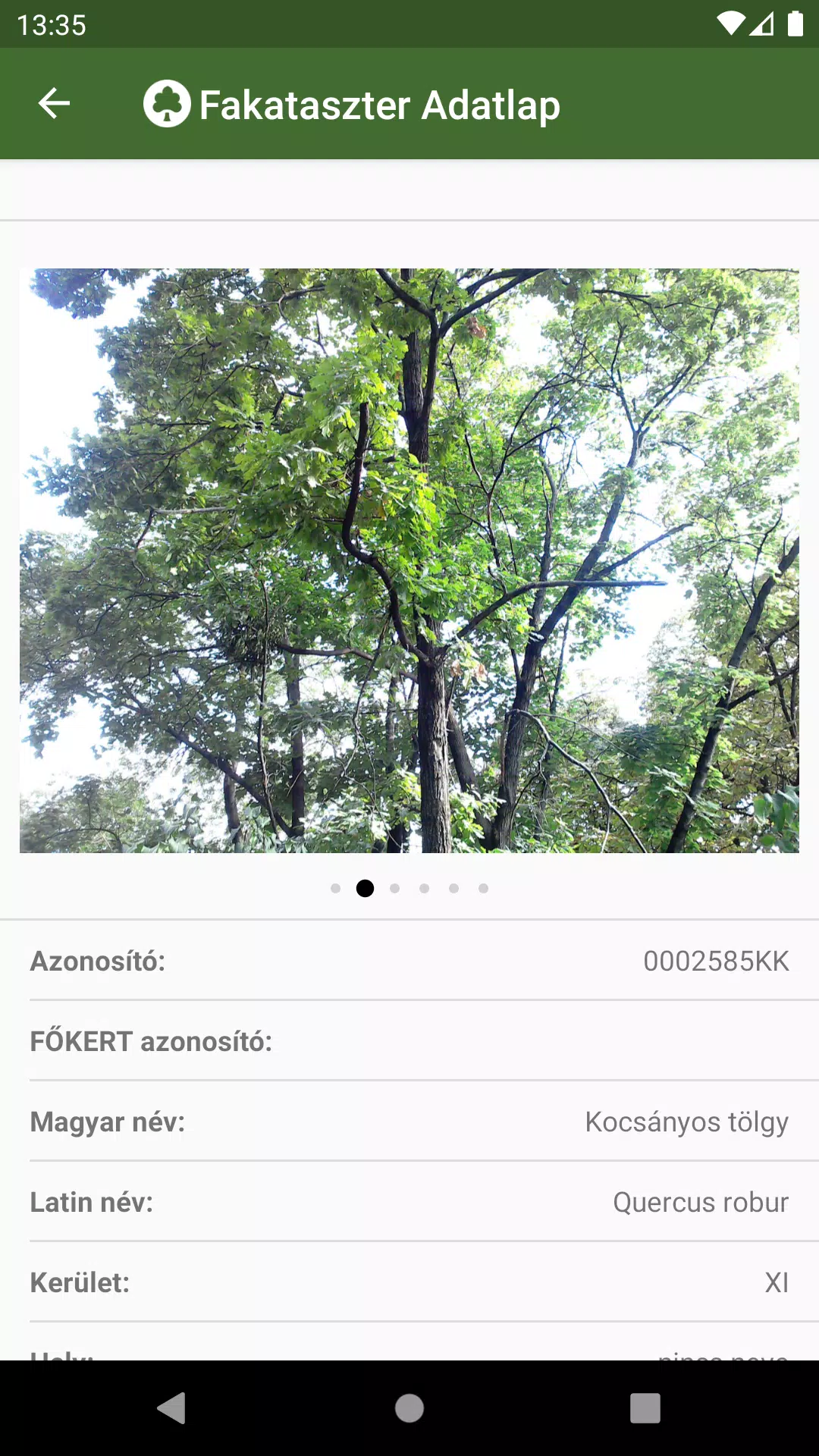
To get started, simply navigate on the map to the location of interest. Click on the points, lines, or surfaces representing the cadastral elements to access detailed data sheets. These sheets provide comprehensive information about the selected element, complete with accompanying photos to enhance your understanding.
Our application features an integrated, detailed search engine to streamline your navigation:
- Search by tree species in the tree scanner, using either Hungarian or Latin names.
- Search through categories grouped in the park cadastre.
Upon searching, the map will highlight the locations of all cadastral elements that match your criteria, making it easy to pinpoint what you're looking for.
If you notice any issues, such as a damaged tree or bench, you can report them directly to the data manager's employees listed on the data sheet. Just click the "Error report" button on the data sheet of the affected element to initiate the process.
What's New in the Latest Version 1.5.2
Last updated on Oct 20, 2024
Bug fixes.
BP Fatár Screenshots
Reviews
Post Comments
Trending Games
Trending apps

![NULL [Remastered]](https://imgs.39man.com/uploads/71/1719651062667fcaf6c483b.png)


Topics
More
Best Tools for Home Improvement Projects
Fun Educational Games to Learn and Play
Immersive Strategy Games: Dive into Tactical Combat
Hyper-Casual Games: Fun and Addictive Mobile Games
Essential Tools for Everyday Life
Top Lifestyle Apps to Enhance Your Life
Top-Rated Adventure Games to Play Now
Best Strategy Games for Android
Latest Articles
More

"Switch 2 Outshines Original: 10 Key Upgrades"
Apr 24,2025
Latest Updates on FragPunk
Apr 24,2025
Roblox Meme Race: January 2025 Codes Unveiled
Apr 24,2025
Best Times to Buy a New iPad Annually
Apr 24,2025