

Application Description
OfflineMaps provides you with access to an extensive collection of maps, ensuring you can navigate with ease and confidence, no matter where you are.
No advertisements ~ No data sharing & monetization ~ No analytics ~ No third party libraries
Tired of waiting for maps to load? With All-In-One OfflineMaps, once a map is displayed, it's stored for quick access, even without an internet connection.
• Looking for more than just road maps? You'll find a variety of options here;
• Frequently visit areas with poor network coverage? Your maps will remain accessible;
• Traveling abroad? Say goodbye to getting lost;
• Concerned about data limits? OfflineMaps helps reduce your data usage.
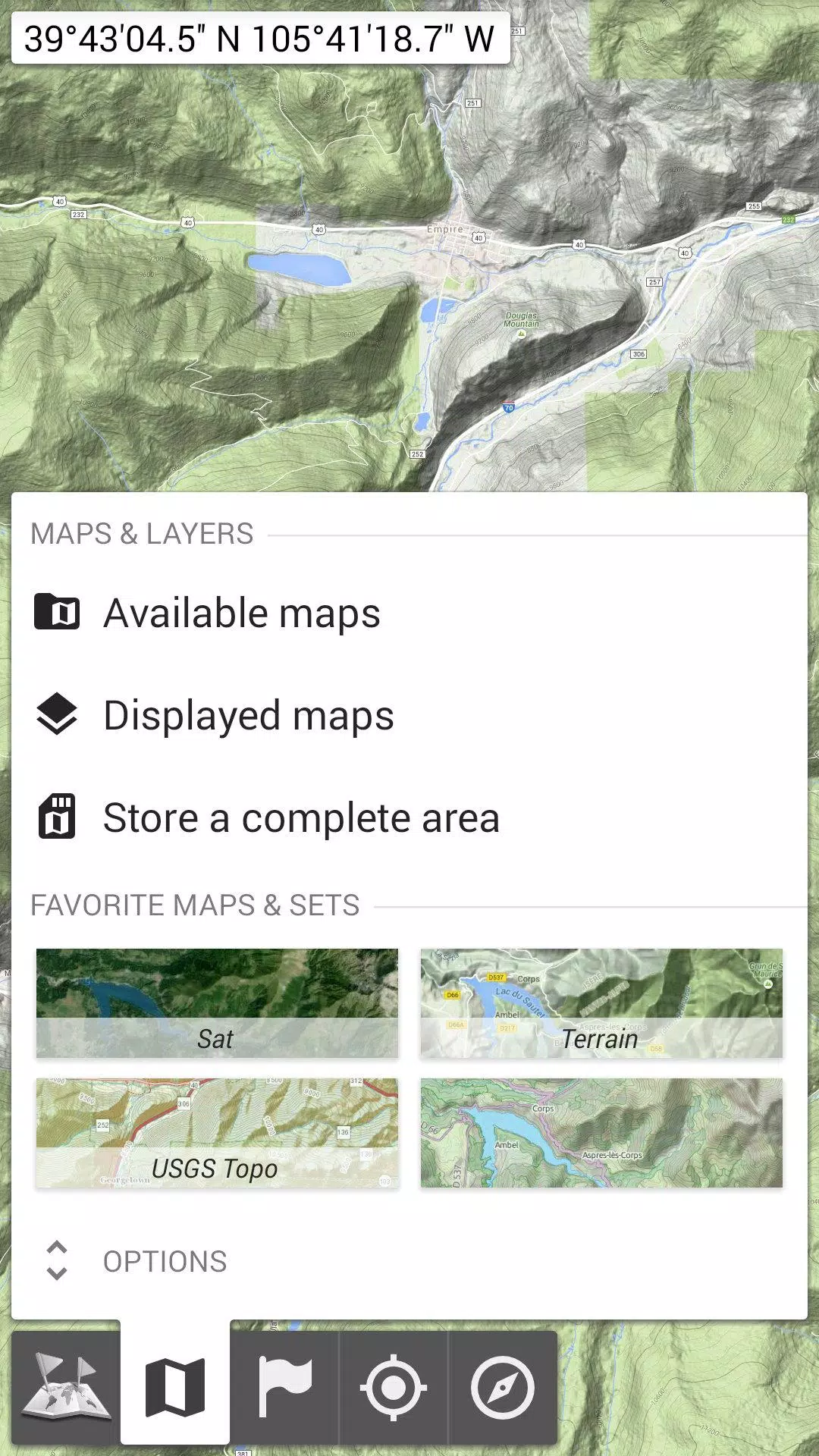
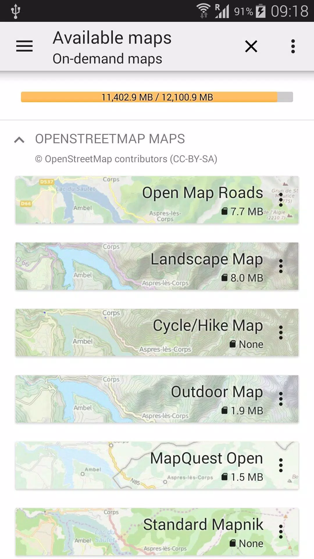
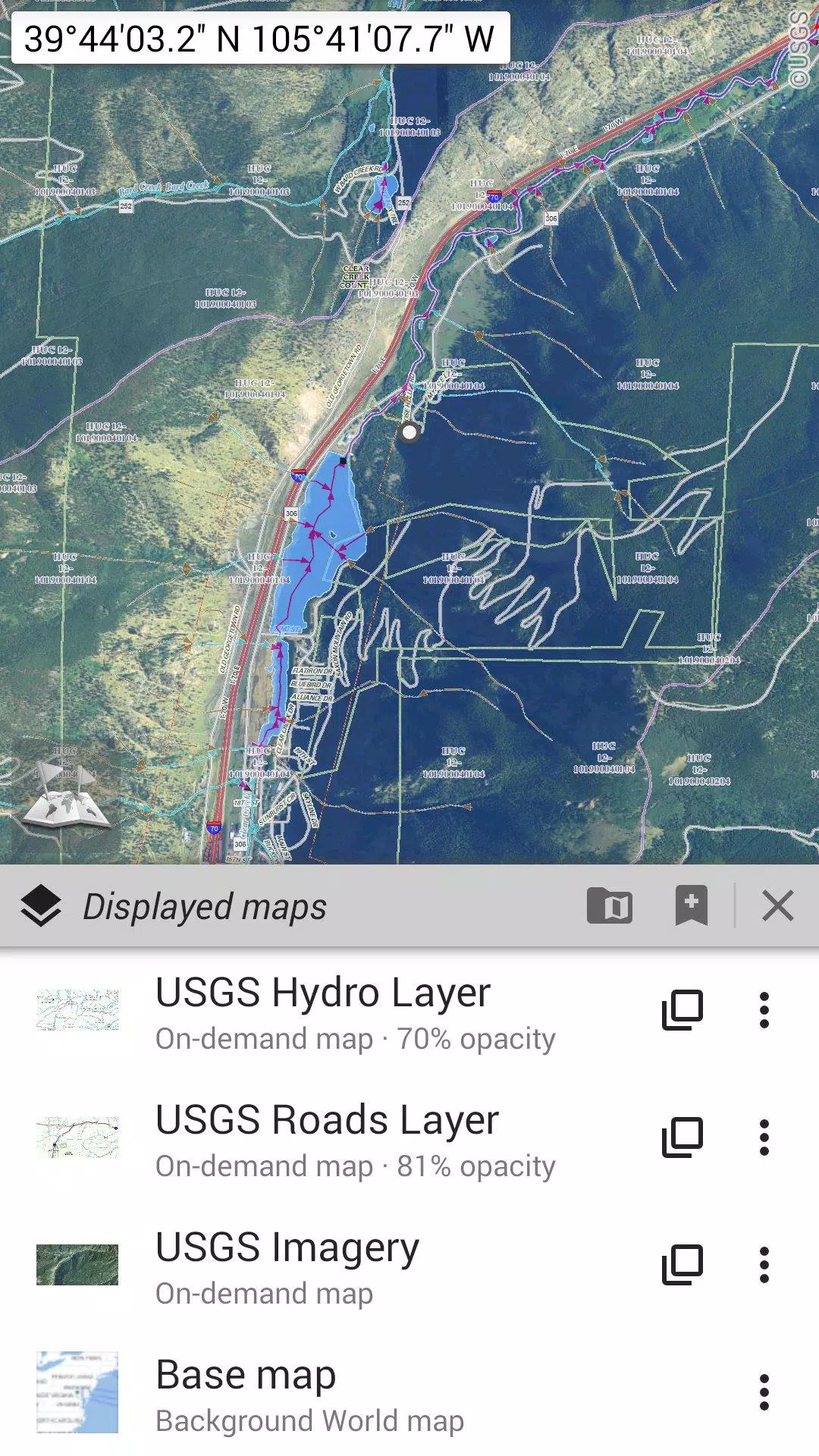
★★ Maps ★★
Explore a wide range of maps, from traditional road maps to topographic and aerial (satellite) maps. You can also overlay various layers such as OpenStreetMap (Roads, Topo), USGS National Map (Hi-res topo, Aerial imagery), and Worldwide Military Soviet topo maps, among others.
• Layer multiple maps with adjustable opacity;
• Easily select and store large areas with just a few clicks;
• Manage stored map data effortlessly, with clear options for deletion.
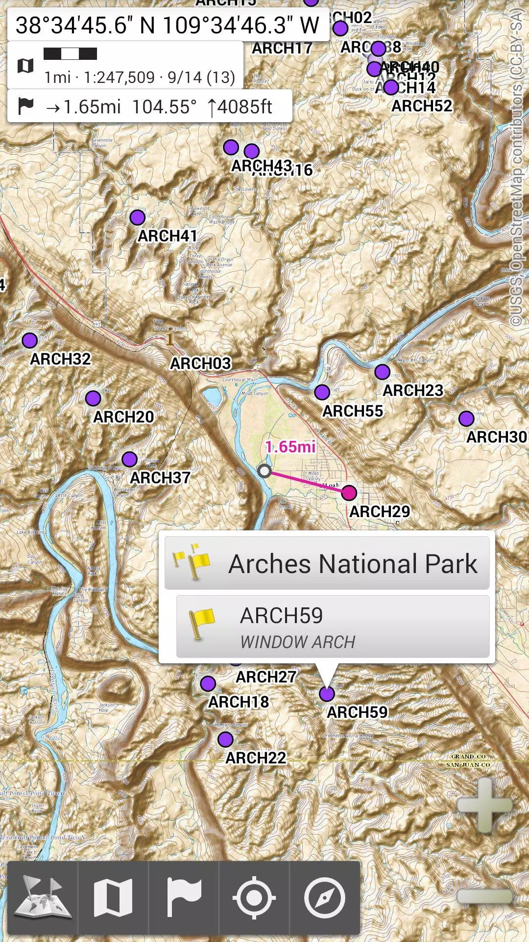
★★ Display, Store, and Retrieve Unlimited Placemarks ★★
Enhance your maps by adding waypoints, icons, routes, areas, and tracks. Organize and manage these items seamlessly with the SD-Card Placemarks Explorer.
★★ On-Map GPS Location & Orientation ★★
See your real-time location and direction directly on the map, which can be rotated to align with your actual orientation (device capability dependent).
Conserve battery life with easy on/off controls.
Additional features include:
• Choice of metric, imperial, or hybrid distance units;
• Support for various GPS coordinate formats such as Latitude/Longitude, UTM, MGRS, USNG, OSGB Grid, Irish Grid, Swiss Grid, Lambert Grids, DFCI Grid, QTH Maidenhead Locator System, and more;
• Import capabilities for hundreds of coordinate formats from https://www.spatialreference.org;
• On-map grid displays;
• Full-screen map view;
• Multi-touch zoom;
• And much more.
★★ Need More? ★★
For the ultimate outdoor experience, consider AlpineQuest Off-Road Explorer, built on the foundation of All-In-One OfflineMaps. It includes a robust GPS Track Recorder and additional features to enhance your adventures: https://www.alpinequest.net/google-play
All-In-One Offline Maps Screenshots
Reviews
Post Comments
Trending Games
Trending apps

![NULL [Remastered]](https://imgs.39man.com/uploads/71/1719651062667fcaf6c483b.png)


Topics
More
Top-Rated Productivity Tools to Boost Your Workflow
Best Casino Games Online
Essential Other Apps for Your Phone
Best Role Playing Games for Android
Epic Adventure Games: Explore Uncharted Worlds
Hyper-Casual Games: Fun and Addictive Mobile Games
Top Arcade Classics and New Hits
Best Media & Video Players for Android
Latest Articles
More


"Pokémon Go Tests Go Pass in Select Regions"
Apr 28,2025
Pikmin Bloom's Official Walk Party for Earth Day
Apr 28,2025