

Application Description
2GIS is your ultimate navigation companion, offering an offline map, GPS navigation, live traffic updates, parking information, transit routes, and much more. Whether you're driving, walking, or using public transport, 2GIS provides a comprehensive solution to help you navigate with ease.
With 2GIS, you can download detailed maps to your device, ensuring you never get lost, even without an internet connection. This feature is perfect for travelers and locals alike, making you feel at home even in unfamiliar places. You can easily find addresses, company details, phone numbers, working hours, and information about goods or services. Navigate to your destination by car, bus, subway, or on foot with the help of the built-in GPS navigator.
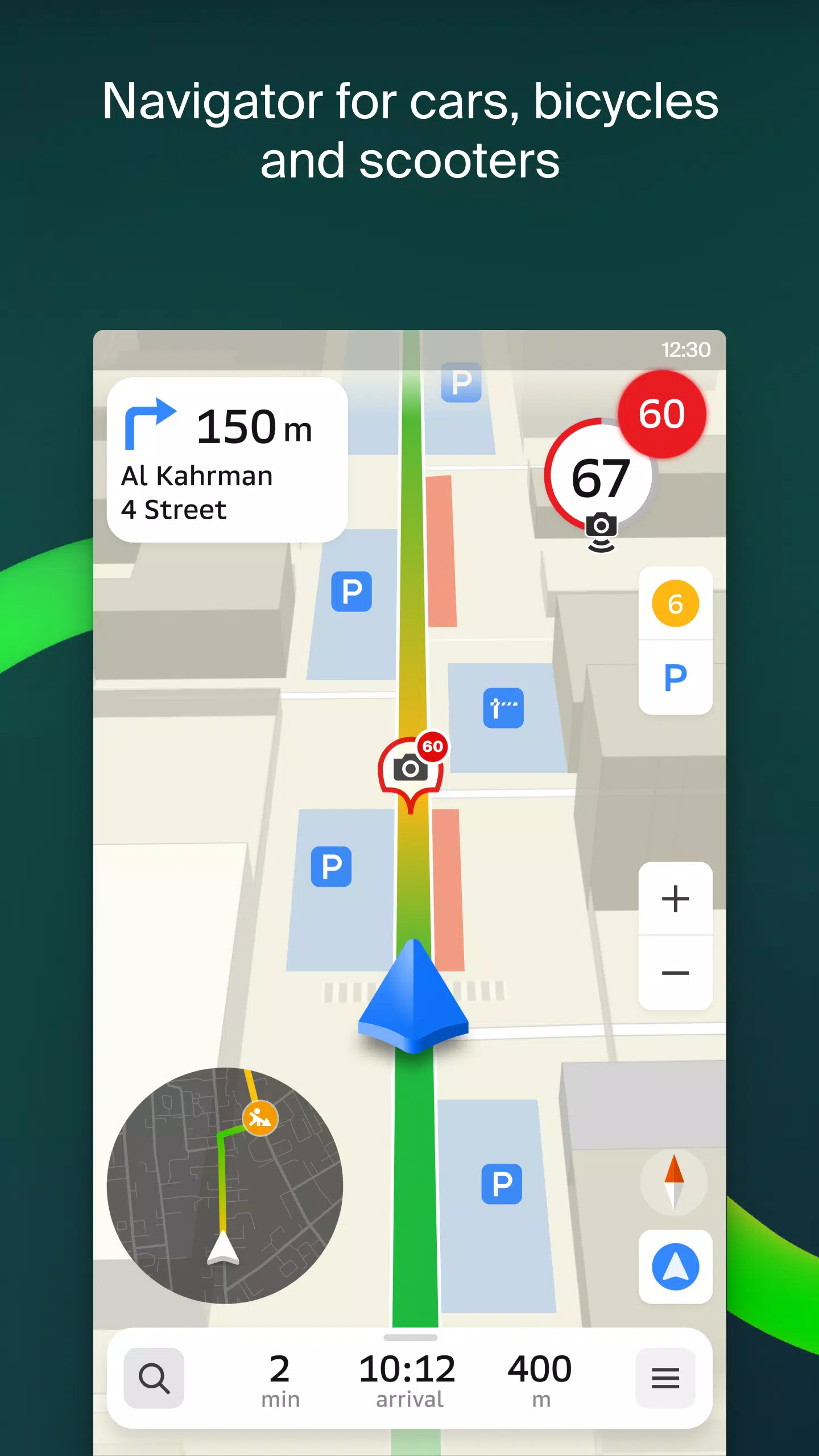
2GIS offers accurate maps that include districts, buildings, streets, bus stops, subway stations, gas stations, sports grounds, and other points of interest. The GPS navigation system takes into account real-time traffic conditions, road signs, speed cameras, toll roads, and unpaved roads, providing optimal routes between cities and through multiple points. There's also a free app available for Android Auto, enhancing your driving experience.
Stay connected with friends and family using the live friends' location feature. Track the GPS location of your kids or friends to ensure their safety, send fun stickers, and check their battery charge. You have full control over who can see your location and can manage sharing settings as needed.
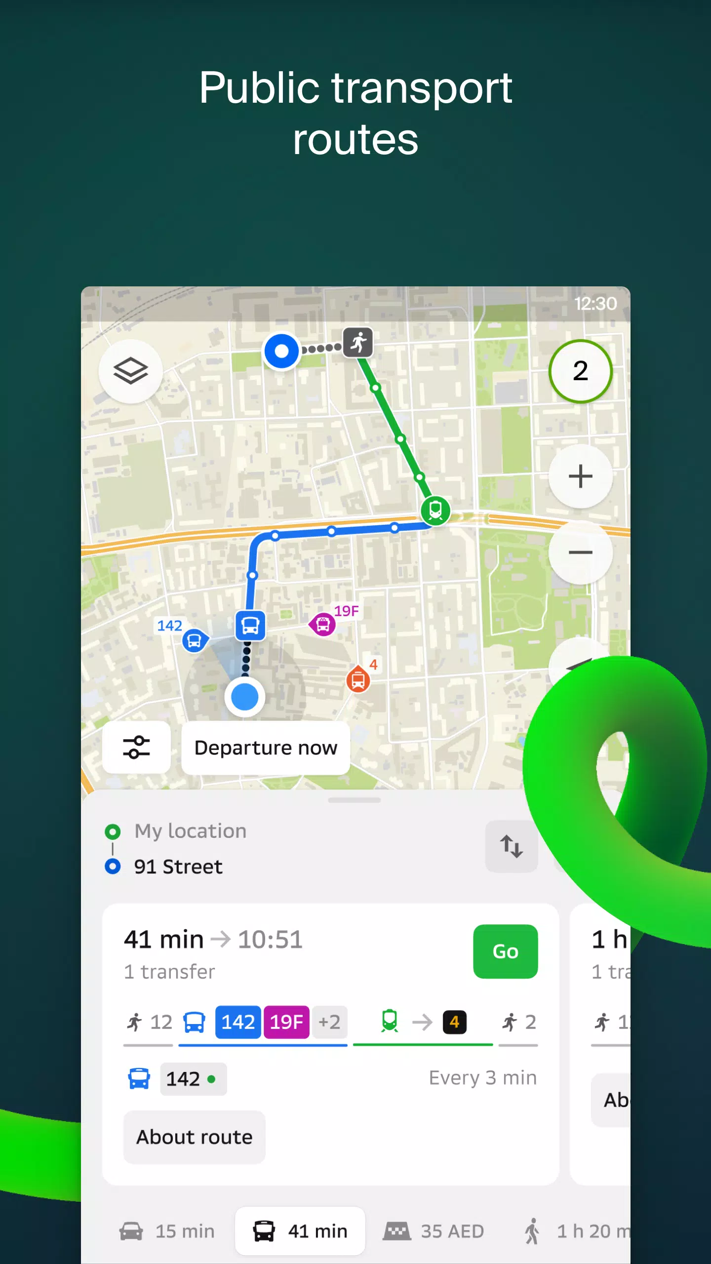
Stay informed about road events such as accidents, blocked streets, and speed cameras, all displayed directly on the map. 2GIS also provides detailed public transport information, including timetables and online routes, making it easy to plan your journey.
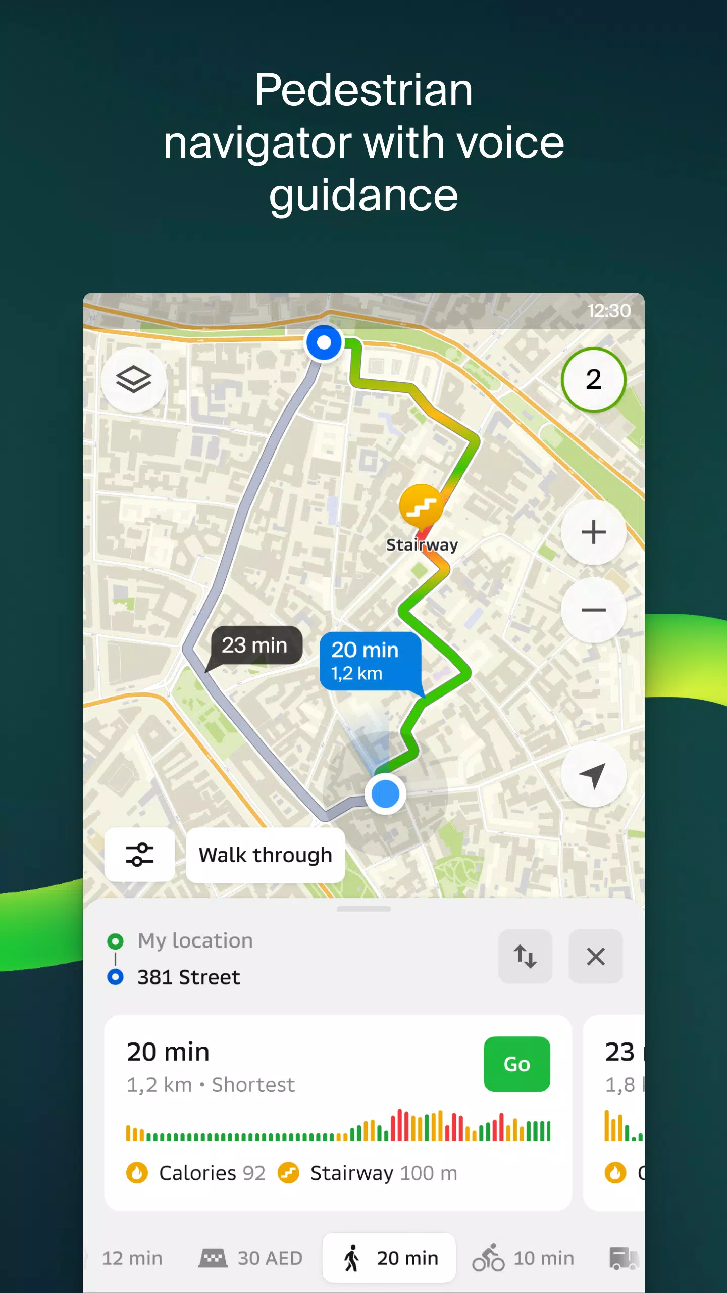
For pedestrians, 2GIS offers walking routes with background navigation and voice guidance, ensuring you reach your destination effortlessly. Truck drivers can benefit from the cargo navigator, which considers the specific characteristics of vehicles and cargo when plotting routes.
The detailed directory in 2GIS includes addresses, entrances, postal codes, phone numbers, working hours, social media links, websites, and entrance locations. Users can add photos and write reviews, enhancing the information available for each listing.
Explore new cities like a local with the travel guide feature, which highlights main attractions and places with Wi-Fi. For smartwatch users, the 2GIS Notifications companion app for Wear OS 3.0 or later versions offers a convenient way to navigate routes on foot, by bike, or by public transport. The app provides map views, maneuver hints, and vibration alerts when approaching turns or destination bus stops, starting automatically when you begin navigation on your phone.
2GIS is available in numerous cities across the UAE, Russia, Belarus, Kazakhstan, Uzbekistan, Azerbaijan, and Kyrgyzstan, including Dubai, Sharjah, Abu Dhabi, Moscow, Saint Petersburg, Minsk, Almaty, and many more. For any support, you can reach out to [email protected].
2GIS: Offline map & navigation Screenshots

Reviews
Post Comments
Trending Games
Trending apps


![NULL [Remastered]](https://imgs.39man.com/uploads/71/1719651062667fcaf6c483b.png)


Latest Articles
More


"Pokémon Go Tests Go Pass in Select Regions"
Apr 28,2025
Pikmin Bloom's Official Walk Party for Earth Day
Apr 28,2025